Beyond the Grand Canyon: 8 Under-the-Radar Southwest Gems You've Never Heard Of
Discover 8 spectacular hidden gems in the American Southwest — from White Pocket's swirling sandstone to Bisti's alien wilderness. No permits, no crowds.
Beyond the Grand Canyon: 8 Under-the-Radar Southwest Gems You've Never Heard Of
The Grand Canyon welcomed nearly 5 million visitors in a single year. Zion National Park isn't far behind. During peak season, you'll wait over an hour just to get a parking spot at Horseshoe Bend. The American Southwest is one of the most spectacular regions on Earth — and also one of its most congested.
But here's the thing: the Southwest is vast. Arizona, Utah, Nevada, and New Mexico together cover more than 500,000 square miles, and the overwhelming majority of visitors concentrate on fewer than a dozen marquee sites. Thirty minutes off the main highway, the crowds vanish. The silence returns. And some of the most surreal, jaw-dropping landscapes on the continent sit almost entirely to themselves — no permit lottery, no shuttle queue, no parking-fee line.
These are eight of them. Each is genuinely spectacular, genuinely undervisited, and genuinely worth going out of your way for. And if you're planning the broader trip around them, our complete US road trip planning guide covers routing, gear, and everything else you'll need.
1. White Pocket, Arizona — The Wave's Crowd-Free Cousin
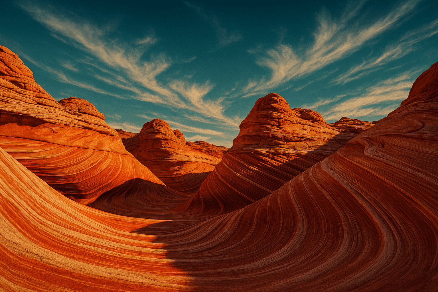
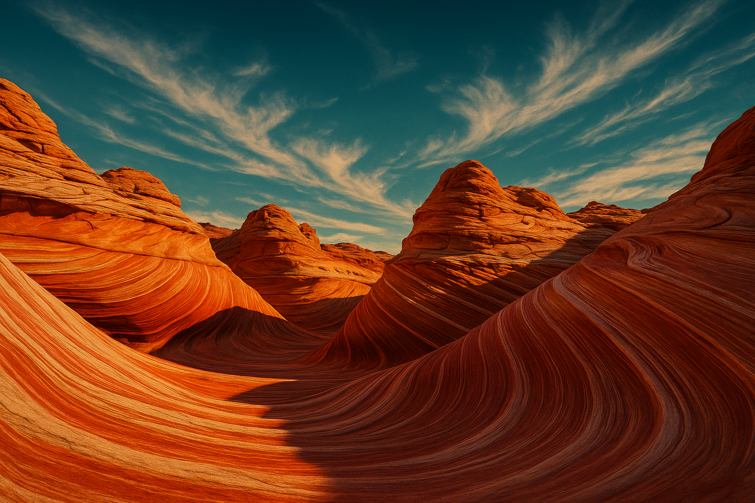
White Pocket delivers the same swirling sandstone drama as the famous Wave — no permit lottery, no daily cap, almost no one else there.
The Wave at Coyote Buttes has become so sought-after that the Bureau of Land Management runs a permit lottery — and your odds on any given application day hover around 10%. White Pocket, located just a few miles away within the same Vermilion Cliffs National Monument, delivers comparable magic without the gatekeeping. The terrain is an otherworldly mosaic of white, pink, and crimson Navajo sandstone, folded and contorted into brain-like undulations, cross-bedded fins, and stacked pancake layers. As the sun moves, the colors shift from pale cream in midday light to deep rose and amber at golden hour.
Getting there: The access road runs 35+ miles of sandy 4WD-only track from Kanab, Utah, or Page, Arizona. High-clearance 4WD is non-negotiable — two-wheel-drive vehicles regularly get stuck in the soft sand washes. Guided tours from both towns are available if you don't have a capable vehicle.
Best time: March–May or September–October. Summer temperatures exceed 100°F and the exposed sandstone provides zero shade.
Tip: Aim to arrive before 8 a.m. for warm, directional light on the rock. Midday sun bleaches the colors and makes sustained exploration genuinely dangerous.
2. Bisti/De-Na-Zin Wilderness, New Mexico — America's Most Alien Landscape
Bisti/De-Na-Zin is a 45,000-acre trackless badlands with hoodoos, petrified wood, fossilized dinosaur bones, and landscapes so strange they've been used as Mars stand-ins in film productions.
Forty-five miles south of Farmington in northwestern New Mexico, this BLM-managed wilderness was once a shallow inland sea during the Cretaceous period — 70 million years of erosion made strikingly visible. The signature "cracked egg" formations are large, spherical mud concretions that split open to reveal crystal interiors. Tall hoodoos cluster in groups; the light at sunset turns them copper.
There are no maintained trails, no facilities, and no cell service. Navigation is by GPS and landmarks. The BLM manages this land specifically to preserve its wilderness character, which means it remains one of the few places in the contiguous Southwest where solitude is genuinely guaranteed. Day use is free; no permit required.
Getting there: Turn off Highway 371 south of Farmington; a dirt road leads to the parking area. Standard vehicles manage fine in dry conditions, but the clay-rich soil becomes impassable when wet — check forecasts.
Best time: October through April. Summer heat is severe, and afternoon monsoon thunderstorms can make the roads instantly dangerous.
Tip: Download offline GPS maps before you leave cell range. The "cracked eggs" field sits roughly 2.5 miles east of the south trailhead — use it as your navigation anchor.
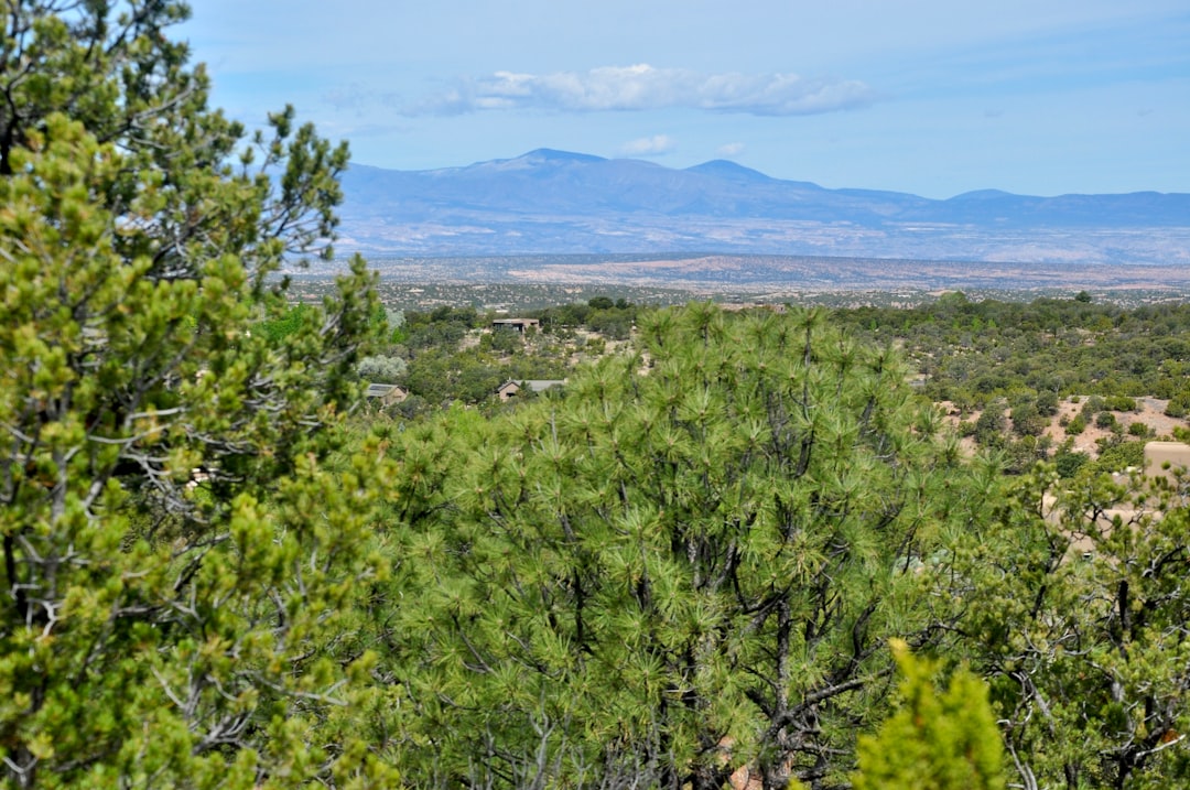 Photo by Dan Dennis on Unsplash
3. Valley of Fire State Park, Nevada — Las Vegas's Most Overlooked Day Trip
Valley of Fire sits 55 miles from the Las Vegas Strip and is Nevada's oldest state park — yet it sees a fraction of the visitors of any nearby national park, with some of the most photogenic red sandstone in the Southwest.
The Aztec sandstone formations glow a deep, almost violent red at sunrise and sunset — hence the name. Elephant Rock, the Beehive Structures, Arch Rock, and the Fire Wave trail (a 1.5-mile round trip through red-and-white undulating sandstone) are the highlights. The park also contains some of the most accessible petroglyphs in the region: ancient Ancestral Puebloan rock art at Atlatl Rock, visible from a short paved walk.
Getting there: About 55 miles northeast of Las Vegas via I-15 and Highway 169 — roughly a 55-minute drive. Easy day trip; staying overnight at one of the park campgrounds puts you in position for sunrise light that transforms the rock into something molten.
Best time: October through April. July and August temperatures regularly top 110°F, making sustained hiking genuinely dangerous. Midweek visits are significantly quieter than weekends.
Note: Valley of Fire is a state park, not a national park — the America the Beautiful annual pass doesn't apply, but the entry fee is modest. Bring all food and water; there are no dining facilities inside.
4. Goblin Valley State Park, Utah — A Valley You Can Completely Roam
Goblin Valley is the one place in the Utah desert where you're invited to wander freely among thousands of sandstone hoodoos — scrambling, squeezing, exploring — with no ropes, no fences, no single designated path.
Wedged between Capitol Reef and Canyonlands in south-central Utah, the valley floor is carpeted with Entrada Sandstone formations in a distinctive mushroom shape: rounded caps balanced on narrowing pedestals, carved by differential erosion over millions of years. The "goblins" range from knee-high to taller than a standing adult. Natural caves pock the canyon walls; the whole place feels like a playground designed by geology and time.
Getting there: 12 miles north of Hanksville on Highway 24, then along a paved spur road. Standard vehicles are fine. The park has a campground with electrical hookups and yurt glamping options available.
Best time: March–May and September–November. Late afternoon light turns the goblins amber and shadows sharpen every surface.
Combine it with: A Capitol Reef National Park scenic drive (80 miles) or a Green River float trip near Moab (95 miles) for a loop that stays entirely off the standard tourist circuit.
5. Kasha-Katuwe Tent Rocks, New Mexico — Slot Canyon and Cone Field in One
Kasha-Katuwe offers the rare combination of a slot canyon hike and a field of cone-shaped volcanic formations — 40 miles from Santa Fe, on one of the least-visited BLM properties in New Mexico.
"White cliffs" in Keresan, the language of the Pueblo de Cochiti on whose land the monument sits, Kasha-Katuwe was formed by volcanic eruptions 6–7 million years ago. Pumice and tuff deposits eroded into tent-shaped cones, each capped with a harder basalt boulder that protected the softer material beneath. The Slot Canyon Trail (3 miles round trip, moderate) winds through a narrow, shaded gorge before climbing to a mesa with panoramic views across the Rio Grande valley and Jemez Mountains.
Getting there: I-25 to exit 264, then NM-22 west toward Cochiti Lake. ⚠️ Important: the monument has experienced periodic closure days due to co-management logistics between the BLM and Pueblo de Cochiti. Check recreation.gov for current status before making the drive.
Best time: Spring and fall. The slot canyon provides natural shade, but the mesa climb is fully exposed to sun.
6. Grand Falls of the Little Colorado River, Arizona — A Waterfall Taller Than Niagara
Grand Falls stands 185 feet tall — 17 feet taller than Niagara Falls — runs chocolate-brown with sediment, and is almost entirely unknown outside northern Arizona.
Located on Navajo Nation land about 30 miles northeast of Flagstaff, Grand Falls is the Little Colorado River at its most dramatic: swollen by snowmelt or summer monsoons, carrying thick red sediment over a wide basalt ledge in a thundering cascade. This is not a postcard waterfall — it's a force-of-nature waterfall, raw and brown and loud.
Getting there: North on Route 89 from Flagstaff, then east on Leupp Road to the signed turnoff. The final stretch is a dirt road, manageable by standard vehicles in dry conditions. A Navajo Nation day-use permit (modest fee) is required at the site.
Critical timing: Grand Falls is a strictly seasonal destination. It runs reliably during snowmelt — typically mid-March through April — and again after summer monsoon rains in August–September. Outside those windows, the riverbed can be completely dry. Check recent trip reports on hiking forums before making the drive.
7. Wupatki National Monument, Arizona — Ancient Ruins on the Grand Canyon Highway
Wupatki is one of the Southwest's most significant Ancestral Puebloan sites — a 100-room red sandstone pueblo from around 1100 CE — sitting directly on the highway corridor between Flagstaff and the Grand Canyon, passed by nearly every tourist who makes that drive.
At its height around 1150 CE, Wupatki Pueblo was the largest building for 50 miles in any direction, inhabited by roughly 100 people at the intersection of multiple trading cultures. The site includes a Mesoamerican-style ball court (evidence of trade connections hundreds of miles to the south) and a natural blowhole — a crack in the earth that exhales or inhales air depending on the pressure differential between the surface and underground chambers.
Getting there: Wupatki anchors a 36-mile scenic loop road that also passes Sunset Crater Volcano National Monument. Both are covered by a single entry fee or an America the Beautiful pass. Plan 3–4 hours to see both sites properly. If you're extending your Southwest itinerary into more national parks and monuments, Wupatki fits naturally into any northern Arizona circuit.
Best time: Year-round. Spring and fall are most comfortable; in summer, visit before 9 a.m. to avoid peak heat.
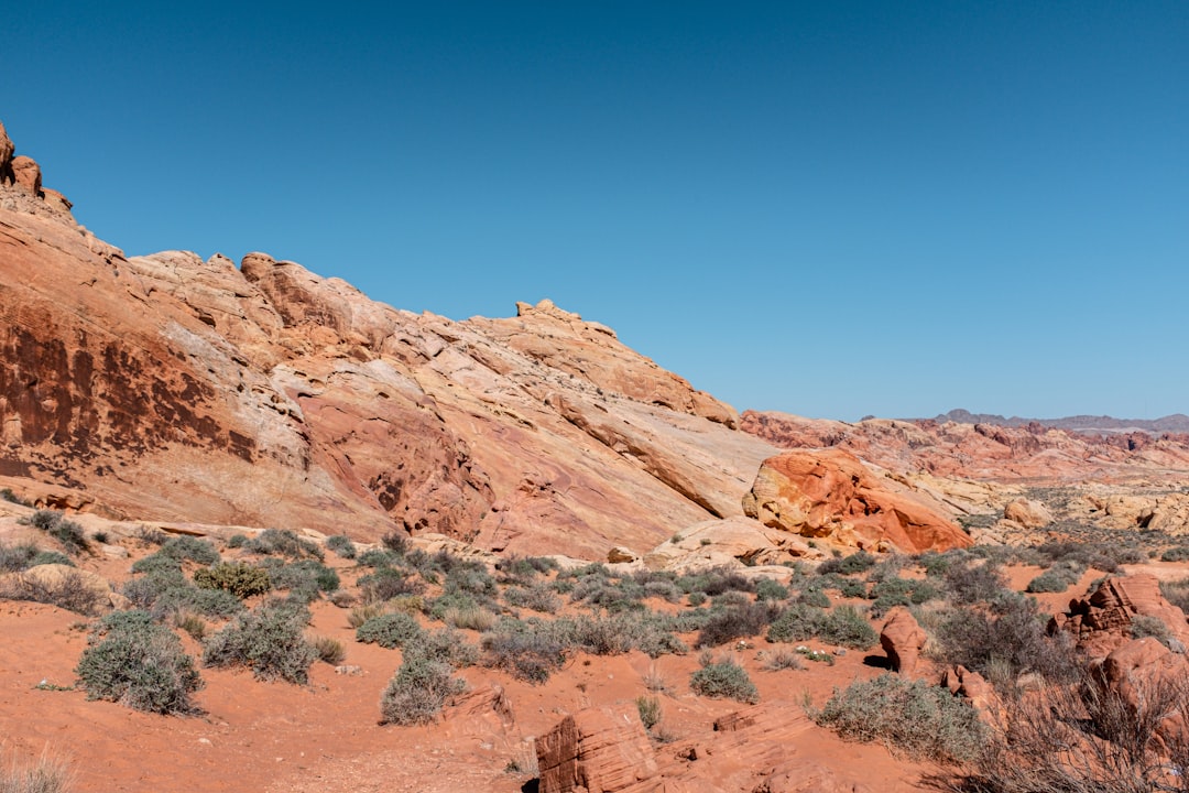 Photo by Maddy on Unsplash
8. Abiquiú & Ghost Ranch, New Mexico — Georgia O'Keeffe's Living Canvas
Ghost Ranch is the valley that inspired Georgia O'Keeffe for four decades: a bowl of striated cliffs in red, ochre, mauve, and ash, one hour north of Santa Fe, with hiking, paleontology, and one of New Mexico's least-known paddling lakes.
On US-84, the Piedra Lumbre valley opens into a landscape of layered cliffs that O'Keeffe described as "the faraway" — colors she said seemed impossible to paint without appearing to exaggerate. Ghost Ranch is now a retreat and education center open to day visitors. The on-site Ruth Hall Museum of Paleontology houses fossils of Coelophysis, a small Triassic dinosaur found here in 1947 in one of the largest mass-death fossil sites ever discovered.
Two hiking trails are open without reservations: the Box Canyon Trail (moderate, 2 miles round trip) and the Chimney Rock Trail (strenuous, 3.5 miles to a summit with sweeping valley views). Eight miles south, Abiquiú Lake offers kayak and paddleboard rentals in season — a spectacular and almost entirely undiscovered paddling venue.
Getting there: US-84 north from Santa Fe, approximately 55 miles. Ghost Ranch is well-signed from the highway.
Best time: May through October. Late afternoon light on the cliffs is extraordinary. Summer brings fast-moving afternoon thunderstorms that typically clear within an hour.
Practical Tips for Exploring These Places
Vehicle requirements: White Pocket requires genuine high-clearance 4WD — this is not a suggestion. Bisti and Grand Falls benefit from it but are manageable in standard vehicles under dry conditions. Renting a capable Jeep or truck SUV for any Southwest trip that ventures off pavement is worth the cost.
Water discipline: In desert conditions, carry a minimum of two liters per person for any outing and replenish proactively. Heat-related illness develops faster than your thirst signals register, especially above 95°F.
Shoulder season is king: Mid-March through May and mid-September through October consistently deliver the best combination of temperatures (60–85°F at most elevations), light quality, and thin crowds across all eight sites. Summer works at higher elevations (Ghost Ranch sits above 6,000 feet) but is a genuine safety concern in the low desert.
Leave No Trace: Several of these sites sit on fragile terrain or Indigenous lands. Avoid stepping on cryptobiotic soil crust — the dark, lumpy-looking patches common at Bisti and Goblin Valley — which takes 50–250 years to regenerate and is essential to desert ecology. At Navajo Nation and Pueblo de Cochiti sites, follow posted rules and purchase day-use permits as required.
One more underrated destination worth mentioning: Canyon de Chelly National Monument in northeastern Arizona combines stunning sandstone canyon scenery with one of the richest living Indigenous landscapes in North America — it's free to enter and requires a Navajo guide for canyon-floor access, which makes the visit genuinely immersive. It's among the most overlooked sites in the entire Southwest.
Routing these into a broader trip: White Pocket and Wupatki pair naturally with a Grand Canyon hike — both sit within 100 miles of the South Rim. Bisti, Kasha-Katuwe, and Ghost Ranch form a strong New Mexico triangle anchored by Santa Fe. Valley of Fire works as a Las Vegas day trip; Goblin Valley fits cleanly between Moab and Capitol Reef. For scenic routing between all of them, America's best scenic drives maps out the connecting corridors.
Frequently Asked Questions
What is the most underrated hidden gem in the American Southwest? Bisti/De-Na-Zin Wilderness in New Mexico stands out consistently. Free entry, no permit required, 45,000 acres of alien geology, and virtually no visitors. If you're comfortable navigating without marked trails, it delivers one of the most genuinely wild experiences in the contiguous Southwest.
Do you need a permit to visit White Pocket, Arizona? No permit is currently required for White Pocket — unlike the adjacent Wave at Coyote Buttes, which uses a lottery system. The access requirement is a high-clearance 4WD vehicle; the sandy road is impassable for standard cars and SUVs without 4WD.
Is Valley of Fire worth visiting from Las Vegas? Absolutely. The drive from the Strip takes about 55 minutes, and the park's red sandstone formations, accessible petroglyphs, and slot canyon hikes are dramatically different from anything in the city. Visit on a weekday, bring your own food and water, and plan at least half a day.
What is the best time of year to visit hidden gems in the Southwest? Mid-March through May and mid-September through November consistently offer the best conditions: manageable temperatures (typically 60–85°F), excellent light, and minimal crowds. Summer is viable at higher elevations like Ghost Ranch (above 6,000 feet) but is dangerous in the low desert, where July–August temperatures can reach 115°F.
Can families with children enjoy these places? Valley of Fire, Goblin Valley (children love scrambling among the goblins), Wupatki, and Ghost Ranch all suit families with kids. White Pocket, Bisti/De-Na-Zin, and Grand Falls are better suited to older children and adults comfortable with uneven terrain, navigation without marked paths, and extended sun exposure.
How are these different from America's most underrated cities? These are natural landscapes — remote desert formations, wilderness badlands, ancient ruins — rather than urban destinations. If you're also looking for off-the-beaten-path city experiences, our guide to America's most underrated cities pairs well with this article for a complete Southwest travel plan that covers both nature and culture.
The Southwest You Haven't Seen Yet
The Grand Canyon is magnificent. Zion is breathtaking. Nobody visits the marquee parks and leaves disappointed — they earned their fame honestly. But a region this geologically restless, this vast, and this sparsely populated doesn't exhaust itself at the famous overlooks.
White Pocket, Bisti, Goblin Valley, Grand Falls — these places exist at the same scale of wonder. They just ask a little more of you: an extra hour on a dirt road, a willingness to navigate without waypoints, the patience to time a visit around a waterfall's season. The small barrier is the point. It's what keeps them quiet.
Go slightly further than the crowd. The Southwest will reward you for it every time.
Want to build your own spot list?
Join Spotli.st and share your favorite places with the world.
Create my free account