Hiking in the Grand Canyon: Everything You Need to Know Before You Go
Planning to hike the Grand Canyon? Discover the best trails by difficulty, essential safety rules, gear tips, permit info, and the perfect season to go.
Hiking in the Grand Canyon: Everything You Need to Know Before You Go
Standing at the South Rim for the first time, most people are struck speechless. Then, almost immediately, they want to go down. The canyon pulls you in — a mile of layered rock, ancient silence, and a river that carved all of this over 6 million years. It's one of the greatest spectacles on Earth, and hiking into it is an experience you'll carry for the rest of your life.
But the Grand Canyon is not a place that forgives unpreparedness. The trails are steep, the heat can be extreme, and what feels like an easy descent going down becomes a grueling climb coming back up. Every year, the National Park Service (NPS) carries out more than 300 search-and-rescue operations — most involving hikers who were simply caught off guard.
This guide covers everything you need before you set foot on a Grand Canyon trail: the best seasons, the top trails broken down by difficulty, essential safety rules, gear checklists, permit requirements, and honest answers to the questions most visitors ask first.
Why Hiking the Grand Canyon Is Unlike Anything Else
The Grand Canyon is 277 miles long, up to 18 miles wide, and more than a mile deep. The Kaibab limestone at the rim formed roughly 270 million years ago; the Vishnu Schist at the base of the inner gorge is nearly 1.8 billion years old. Hiking below the rim means descending through geological time — watching the rock change color from creamy white to vivid red to near-black as you drop.
Most national park hikes start at the bottom and climb. Grand Canyon hiking works in reverse: you begin at the top (South Rim: 7,000 feet elevation) and descend into a desert environment that gets hotter and drier with every step. The Colorado River at the canyon floor sits at around 2,480 feet — nearly 5,000 feet below where you started.
That inversion is what makes hiking here extraordinary, and what makes it genuinely dangerous for those who underestimate it. Every step down is a step you'll have to take back up — at altitude, in heat, on rocky terrain.
When Is the Best Time to Hike the Grand Canyon?
Spring (March–May) and fall (September–November) are the best seasons for hiking the Grand Canyon. Temperatures below the rim are manageable, crowds are lighter than summer, and the light is spectacular.
Spring brings wildflowers, occasional rain, and mild below-rim temperatures in the 60–80°F range. Snow can linger on the rim through March, so pack a layer.
Fall is equally excellent — heat eases after August, the canyon walls glow amber in October light, and the rim forest starts to turn. If you're already planning a fall trip around the USA's best fall destinations, the Grand Canyon belongs at the top of your list.
Summer (June–August) is possible but demands respect. The South Rim sits at 7,000 feet, so the rim itself stays pleasant (65–85°F). But the inner canyon regularly hits 110–115°F in peak summer, and the NPS strongly advises against below-rim hiking between 10am and 4pm in hot months. If you hike in summer, start at dawn and be back on the rim before the heat peaks.
Winter (December–February) offers the smallest crowds and a magical snowy rim — but trails above the rim can be icy, requiring microspikes or traction devices. Below the rim, temperatures are mild (40–60°F). An underrated season for experienced, well-prepared hikers.
Grand Canyon Trails: From Easy Strolls to Epic Crossings
The Grand Canyon's trail network covers every ability level — from a paved rim walk suitable for strollers, to a 21-mile rim-to-rim crossing that requires two days and advance permits. Pick up a Grand Canyon hiking map at the Visitor Center or download the NPS trail map before you go — it shows trailheads, water sources, elevation profiles, and shuttle stops at a glance.
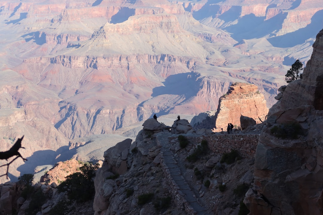 Photo by Theo / Unsplash
Rim Trail — Easy
Distance: Up to 13 miles (most hikers do 1–3 miles) Elevation change: Minimal — mostly flat Water & shade: Available at multiple points along the rim
The Rim Trail runs along the South Rim from Mather Point to Hermits Rest, with large sections that are fully paved. You can join it at any point and walk as much or as little as you like, taking free park shuttles back to your starting point.
Ideal for families with young children, visitors with mobility limitations, or anyone who wants extraordinary panoramic views without descending into the canyon. Don't underestimate it though — even a flat walk at 7,000 feet gets tiring, and viewpoints like Hopi Point and Powell Point deliver views that rival anything in the world.
Best for: Families, first-timers, seniors, anyone not planning a below-rim hike.
Bright Angel Trail — Moderate to Challenging
Distance: 3 miles RT (to 1.5-Mile Resthouse) / 6 miles RT (to 3-Mile Resthouse) / 9 miles RT (to Havasupai Gardens) / 18+ miles RT (rim to river) Elevation change: Up to 4,460 feet to the Colorado River Water: Available seasonally (May–Sept) at 1.5-Mile and 3-Mile Resthouses; year-round at Havasupai Gardens
The Bright Angel Trail is the most famous hike in the Grand Canyon — and the best entry point for first-time below-rim hikers. It descends via wide, well-maintained switchbacks carved into the canyon wall, starting just west of Bright Angel Lodge on the South Rim.
Its critical advantage over all other South Rim trails: it has water. Seasonal water stations at the resthouses make it significantly safer for summer hiking than the waterless South Kaibab.
Natural turnaround points:
- 1.5-Mile Resthouse — Ideal for first-timers. 3 miles RT, ~1,120 ft descent.
- 3-Mile Resthouse — A solid half-day hike with real canyon immersion. 6 miles RT, ~2,120 ft descent.
- Havasupai Gardens — A shaded oasis with cottonwood trees, a campground, and views into the inner gorge. 9 miles RT.
Expect the climb back to take 50–100% longer than the descent. "Just a quick trip to the first resthouse" has surprised many unprepared hikers.
Best for: First-time below-rim hikers, moderate-fitness day hikers, anyone who wants the quintessential Grand Canyon experience.
South Kaibab Trail — Challenging
Distance: 1.8 miles RT (to Ooh Aah Point) / 6 miles RT (to Skeleton Point) / 14+ miles RT (rim to river) Elevation change: Up to 4,780 feet to the Colorado River Water: None below the rim — carry everything you need
The South Kaibab Trail offers the Grand Canyon's most dramatic open-canyon views. Unlike Bright Angel — which follows a drainage — South Kaibab follows a ridge, delivering sweeping 360-degree panoramas from the first steps below the rim.
The trade-off: no water, minimal shade, and a relentlessly steep descent. The NPS explicitly discourages attempting the full rim-to-river round trip via South Kaibab in a single day. The classic strategy: go down on South Kaibab (shorter, steeper, best views) and return up via Bright Angel (longer, but has water and shade).
Popular turnaround points:
- Ooh Aah Point — 1.8 miles RT. Jaw-dropping views. Accessible for most fit hikers.
- Cedar Ridge — 3 miles RT. Best views-to-effort ratio on the South Rim.
- Skeleton Point — 6 miles RT. First view of the Colorado River. Very strenuous.
Best for: Experienced day hikers, those doing the corridor loop (South Kaibab down, Bright Angel up), photographers hunting the best vistas.
Hermit Trail — Challenging to Very Challenging
Distance: 3 miles RT (to Waldron Trail junction) / 5 miles RT (to Santa Maria Spring) Elevation change: ~1,600 ft to Santa Maria Spring Water: At Santa Maria Spring — requires filtration
Starting from Hermits Rest (reached via the free Red shuttle), the Hermit Trail is steeper and rougher than the corridor trails, with loose rock underfoot and occasional exposed sections. Below the Waldron Trail junction, the path is unmaintained.
The reward is solitude. While Bright Angel and South Kaibab are busy from dawn to dusk, Hermit sees far fewer visitors. Santa Maria Spring is one of the more peaceful spots in the entire park — shaded, trickling, and largely crowd-free.
Pack trekking poles, sturdy boots, a water filter, and more water than you think you'll need.
Best for: Experienced hikers who want to escape the crowds.
Shoshone Point — Easy (Hidden Gem)
Distance: 2 miles RT (1 mile each way) Elevation change: Minimal — flat forest path Access: Unmarked gate on Desert View Drive, ~1 mile east of Pipe Creek Vista
Most Grand Canyon visitors never find Shoshone Point. There's no sign at the trailhead — just a gate on the south side of Desert View Drive. Follow a flat mile through quiet ponderosa pine forest and you arrive at a private overlook with sweeping canyon views, picnic tables, and almost no one around.
It's one of the park's best-kept secrets. Perfect for sunrise or sunset photography, and ideal for families who want a genuine viewpoint without fighting the crowds at Mather Point.
Best for: Photographers, families, anyone who wants a world-class view without the crowds.
Rim-to-Rim — Expert Only
Distance: ~21 miles (North Rim to South Rim via North Kaibab + Bright Angel) Duration: 2–3 days recommended; possible in 1 day for elite hikers Permit: Required for all overnight camping below the rim
The Rim-to-Rim is the Grand Canyon's signature multi-day experience — a full crossing from one rim to the other, with a night (or two) at Phantom Ranch on the canyon floor or at a backcountry campground. It involves roughly 10,000 feet of combined elevation change and some of the most remote scenery in the American Southwest.
The North Rim is open from mid-May to mid-October only. Phantom Ranch reservations run on a lottery system that opens 15 months in advance and is heavily oversubscribed — apply early and have a camping backup plan. Most hikers go North to South, as the descent from the North Rim via the North Kaibab Trail is more gradual.
Best for: Fit, experienced hikers with proper advance planning. One of the great hiking experiences in America.
Safety: The Rules That Could Save Your Life
"Going down is optional. Coming up is mandatory."
This phrase appears at every Grand Canyon trailhead, and it's the single most important thing to understand about hiking here. The canyon tempts you downward — but you must be capable of getting back out.
Hydrate aggressively. The NPS recommends 1 liter of water per hour during strenuous below-rim hiking in warm conditions. Pair your water intake with salty snacks (trail mix, jerky, electrolyte tablets) to prevent hyponatremia — a dangerous condition caused by drinking large volumes of water without replenishing sodium.
Avoid peak heat in summer. Stay out of the canyon interior between 10am and 4pm from June through August. Temperatures below the rim can be 20–30°F higher than on the rim, and can exceed 115°F in the inner gorge.
Respect the altitude. The South Rim sits at 7,000 feet — 20% less oxygen than sea level. Many visitors arrive from low-elevation cities and feel short of breath doing things that would normally feel easy. Drink water, eat well, and sleep before any serious hike.
Set — and keep — your turnaround point. Decide before you start, and honor it no matter how good you feel going down. Most rescues involve hikers who pushed past their limit because the descent felt easy.
Tell someone your plan. Leave your itinerary with lodge staff or a travel companion: which trail, your turnaround point, and expected return time.
Keep your distance from wildlife. Grand Canyon squirrels bite regularly — they've been conditioned by decades of visitor feeding. Do not feed or approach any animals.
What to Pack for a Grand Canyon Hike
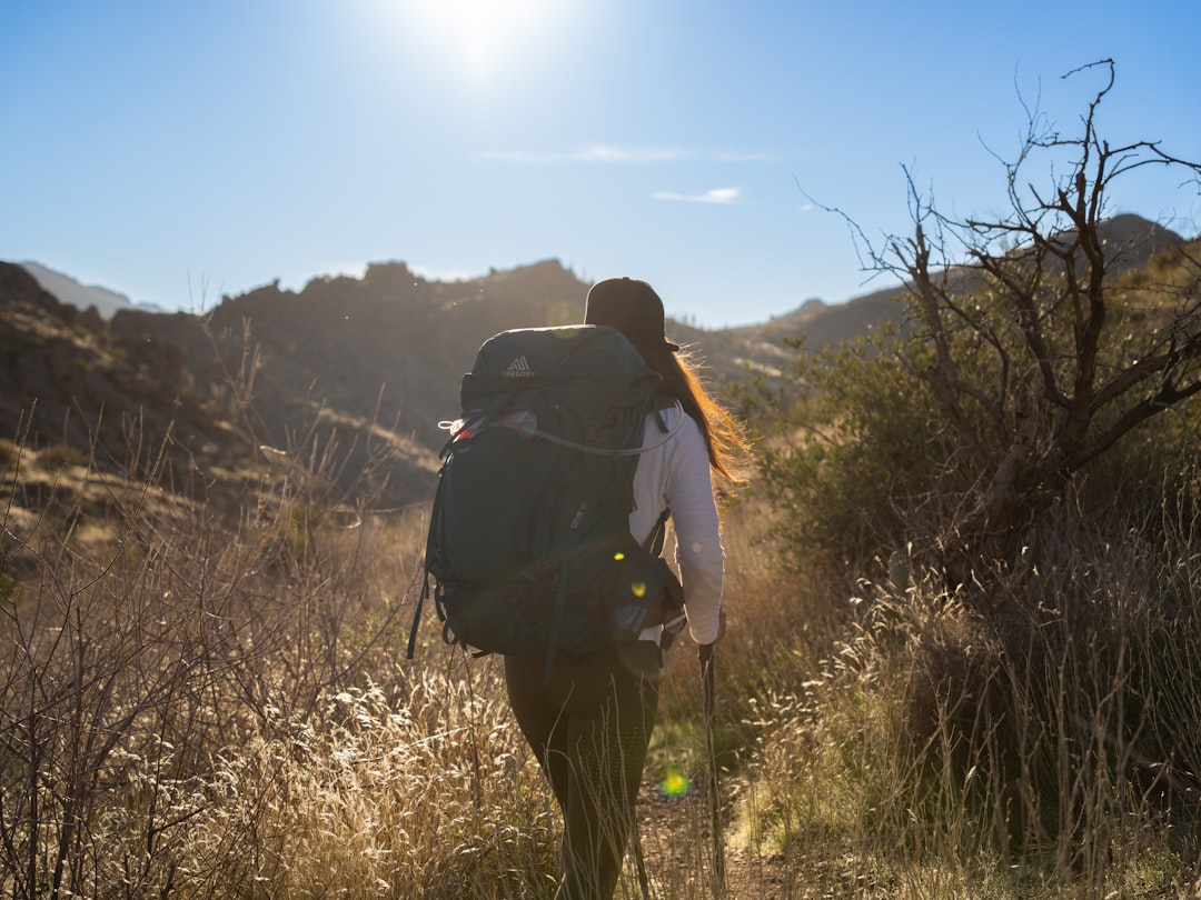 Photo by Alex Moliski / Unsplash
The Grand Canyon's combination of desert heat, high altitude, steep terrain, and limited rescue access demands thoughtful packing. Here's what matters most:
Water: Minimum 2 liters for a short rim-area hike; 3–4 liters for a half-day below the rim. Bring a water filter or purification tablets if you plan to use trail water sources (reliable on Bright Angel and at Santa Maria Spring on the Hermit Trail).
Food: High-calorie snacks with plenty of salt — trail mix, energy bars, nuts, jerky. For hikes past 3 miles below the rim, bring a full lunch.
Sun protection: Wide-brimmed hat (covering the neck — not just a baseball cap), SPF 50+ sunscreen, UV-blocking sunglasses. Arizona sun at altitude is intense.
Footwear: Trail runners or hiking boots with ankle support and aggressive grip. Rocky, loose terrain is the norm; sandals cause injuries every single day.
Layers: Even in summer, rim mornings can be in the 50s°F. Bring a light fleece or jacket; add a wind layer in spring and fall.
Trekking poles: Highly recommended for below-rim hiking — they significantly reduce knee strain on steep ascents and improve stability on loose rock.
Headlamp: In case you're out longer than expected. Light and easy to pack, potentially critical.
First aid basics: Blister plasters, electrolyte tablets, ibuprofen, and any personal medications.
Do You Need a Permit to Hike the Grand Canyon?
Day hiking: no permit required. You can hike the Rim Trail, Bright Angel, South Kaibab, Hermit Trail, Shoshone Point, and most other day routes without any advance paperwork — beyond the park entry fee ($35 per vehicle, valid 7 days). The America the Beautiful Annual Pass ($80) covers entry to all US national parks for a year and pays for itself quickly if you're planning multiple park visits.
Overnight backpacking: yes — a backcountry permit is mandatory. Permits are issued by the Grand Canyon Backcountry Information Center (BIC), with applications opening 4 months before the desired start month. They are in high demand, particularly for spring and fall dates. Apply the moment the window opens.
Phantom Ranch (the only below-rim lodge) operates on a separate lottery system that opens 15 months in advance. Demand far exceeds supply — apply early, and always have a camping backup plan.
Planning Your Trip: Practical Details
Getting there: The South Rim is 80 miles north of Williams, AZ, and about 230 miles northwest of Phoenix. Flagstaff's regional airport (80 miles) is the closest. Many visitors combine the Grand Canyon with a base in Las Vegas — roughly 270 miles away — and there's no shortage of things to do in Las Vegas on either side of your canyon days.
Grand Canyon hiking tours: If you'd rather hike with a guide — particularly for below-rim routes — several operators run half-day and full-day guided hikes from the South Rim covering Bright Angel, South Kaibab, and combination corridor routes. Mule-supported trips to Phantom Ranch are also available for those who want the rim-to-river experience with a lighter load.
Parking: South Rim parking fills up fast in peak season. Use the park's free shuttle network — park once at the Visitor Center and ride the buses for the rest of your visit.
Lodging inside the park: El Tovar Hotel, Bright Angel Lodge, and Maswik Lodge are all on the South Rim and book out months ahead in spring and summer. Reserve the moment you know your travel dates.
The bigger picture: The Grand Canyon is one of the crown jewels of America's national park system — but far from the only one worth the trip. If you're planning a broader US adventure, the best national parks in the USA gives you 10 more wild places that deserve a spot on your list.
Frequently Asked Questions About Grand Canyon Hiking
What is the most famous hike in the Grand Canyon? The Bright Angel Trail is the most famous and most-hiked trail in the Grand Canyon. It's the only South Rim corridor trail with water available below the rim (seasonally), making it the safest and most accessible route for first-time below-rim hikers. The trail descends up to 4,460 feet over 9.5 miles to the Colorado River, with built-in turnaround points at the 1.5-Mile Resthouse, 3-Mile Resthouse, and Havasupai Gardens.
How difficult is hiking the Grand Canyon? Difficulty ranges dramatically. The Rim Trail is flat and paved — suitable for all ages and fitness levels. The Bright Angel Trail to the first resthouse is moderate. Beyond 3 miles below the rim, difficulty increases sharply. The South Kaibab to Skeleton Point or further is very challenging. Rim-to-Rim is expert level. What makes Grand Canyon hiking uniquely hard is the inversion: you descend first, then climb back out in heat and at altitude with already-tired legs.
How long does it take to hike the entire Grand Canyon? The Rim-to-Rim crossing (~21 miles, North to South Rim) is what most people mean by "hiking the entire canyon." Most hikers take 2–3 days, with a night at Phantom Ranch or a backcountry campground. Elite athletes have completed it in under 4 hours as a single-day push — but the NPS does not recommend this, and heat exhaustion risks are significant.
Which Grand Canyon trail is best for beginners? For beginners who want great views without descending: the Rim Trail is unbeatable. For beginners ready for a taste of below-rim hiking: the South Kaibab Trail to Ooh Aah Point (1.8 miles RT) or the Bright Angel Trail to the 1.5-Mile Resthouse (3 miles RT) are both manageable — provided you start early, carry at least 2 liters of water, and are honest with yourself about your current fitness level.
One Last Thing Before You Go
The Grand Canyon rewards preparation and punishes overconfidence — but for those who do it right, it delivers something that's genuinely hard to find anywhere else in the world. A morning below the rim, watching the canyon walls shift from shadow to gold as the sun climbs, listening to the distant rush of the Colorado River far below — it's worth every switchback of the climb back out.
Choose your trail honestly. Go in spring or fall if you can. Carry more water than you think you need. Start earlier than feels necessary. And give yourself time to stop, look up, and take in the full scale of what surrounds you.
The canyon will take care of the rest.
Want to build your own spot list?
Join Spotli.st and share your favorite places with the world.
Create my free account