The Best Scenic Drives in America: 10 Routes Worth Every Mile
Discover America's most scenic drives, from Pacific Coast Highway to Byway 12. 10 unforgettable routes with distances, best seasons & practical tips.
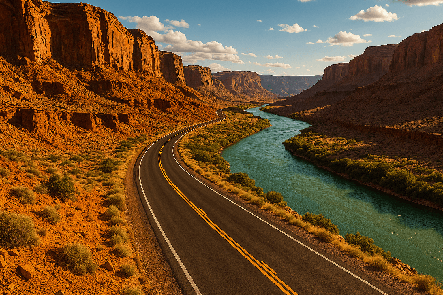
The Best Scenic Drives in America: 10 Routes Worth Every Mile

In the United States, the drive often is the destination. No other country has invested so deliberately in roads that exist specifically to showcase landscape — carving through canyon walls, clinging to coastal cliffs, threading between glaciers. The result is a network of highways that double as experiences.
The most scenic drives in America share three things: they're organized around spectacular natural scenery rather than efficiency, they reward a slow pace, and they leave you understanding something about the country that no airport terminal or city hotel room ever could.
These 10 routes — spanning the Pacific Coast, the Mountain West, the Desert Southwest, the Southeast, and New England — represent the best of what America's roads have to offer. They're organized by region so you can plan a focused trip or build a multi-region journey.
The Pacific Coast: Open Road, Endless Ocean
No region in America does scenic drives quite like the West Coast. Here, the highway often feels suspended between the sea and the sky.
Pacific Coast Highway (PCH) — California | ~620 miles
The Pacific Coast Highway (California State Route 1) is the most iconic scenic drive in the United States, and its reputation holds up. Running from Dana Point in Orange County north to Leggett in Mendocino County, it traces more than 600 miles of California coastline.
The unmissable stretch is Big Sur, between Carmel and San Simeon — roughly 90 miles where the highway clings to cliffs that drop straight into the Pacific. Bixby Creek Bridge, one of the most photographed spans in California, appears suddenly around a curve with the ocean crashing 260 feet below. The Big Sur section alone is a complete drive; you don't need 600 miles to understand why it's legendary.
Distance: ~620 miles end-to-end; the Big Sur core section is about 90 miles.
Drive time: 2–3 hours for Big Sur alone; 3–5 days for the full route.
Best season: March–May and September–November. Summer fog often blankets Big Sur in the morning, and summer traffic turns pull-outs into parking lots.
Don't miss: Point Lobos State Natural Reserve (Carmel), Pfeiffer Beach — its sand turns purple from manganese garnet in the cliffs, Hearst Castle in San Simeon, and the Henry Miller Memorial Library for a coffee stop with literary history.
Practical tip: Big Sur has no cell service for long stretches and gas stations are scarce between Carmel and Cambria — fill up before you enter and download offline maps.
 Photo by Shelby White on Unsplash
Road to Hana — Maui, Hawaii | 64 miles
The Road to Hana (Hāna Highway) is technically only 64 miles — but plan on a full day. The road crosses more than 59 bridges (46 of them single-lane) and navigates over 600 curves as it winds along Maui's rainforest coast. Speed is irrelevant here; the experience is everything just off the pavement.
Waterfalls appear without warning — Twin Falls, Waikamoi Falls, the cascading pools at Ohe'o Gulch (Seven Sacred Pools). The rainforest shifts between microclimates as you descend, and roadside stands sell fresh coconut water and banana bread baked that morning.
Distance: 64 miles one-way.
Drive time: 3–4 hours driving; 8–10 hours with stops.
Best season: Weekday mornings year-round. The road gets congested by mid-morning on weekends.
Don't miss: Garden of Eden Arboretum at mile marker 10, Ke'anae Peninsula for a dramatic lava-coast viewpoint, and Wai'ānapanapa State Park for its black sand beach — one of the most dramatic landscapes in the entire Pacific. If you're planning to snorkel during your Hawaii trip, the island's best snorkeling spots on Maui, Oahu, and the Big Island pair perfectly with a Hana drive day.
The Mountain West: Roads That Touch the Sky
At elevation, scenic drives become something else entirely — altitude-induced awe where the world spreads out below you and the sky feels close enough to touch.
Going-to-the-Sun Road — Glacier National Park, Montana | 50 miles
Going-to-the-Sun Road is the single most dramatic scenic drive in the United States for pure mountain spectacle. Completed in 1932 after 11 years of construction, it crosses the Continental Divide at Logan Pass (6,646 feet), threading through Glacier National Park past glacial lakes of impossible turquoise, along ledges blasted directly from cliff faces, and between peaks still streaked with snowfields in July.
The road is typically open from mid-June to mid-October. Vehicle size is restricted for the scenic section — nothing over 21 feet long or 8 feet wide — and in peak summer the park requires timed-entry reservations.
Distance: 50 miles.
Drive time: 2–3 hours driving; easily a full day with hikes.
Best season: Mid-July through August for full access and maximum wildlife at Logan Pass.
Don't miss: Jackson Glacier Overlook, the turquoise waters of St. Mary Lake, and the short hike from Logan Pass to Hidden Lake Overlook — mountain goats are essentially guaranteed. If you're building a national park road trip around these mountain routes, the best national parks in the USA guide covers the full picture.
Trail Ridge Road — Rocky Mountain National Park, Colorado | 48 miles
Trail Ridge Road is the highest continuous paved highway in the United States, reaching 12,183 feet above sea level. For 11 miles, the road runs above the treeline — above the forests, above the elk meadows, into the alpine tundra where only low-growing plants survive the wind.
From this altitude, the scale of the Rockies becomes comprehensible in a way that simply doesn't happen from below. Elk and mule deer are commonly spotted in the meadows; marmots and pikas appear at higher elevations. Afternoon thunderstorms build quickly above 11,000 feet in summer — plan to be at the highest point before noon.
Distance: 48 miles.
Drive time: 2–3 hours without stops; easily a full day with hikes.
Best season: July–early October. The road closes to the summit by mid-October.
Don't miss: Alpine Visitor Center at 11,796 feet (the highest visitor center in the US national park system), Milner Pass on the Continental Divide, and Forest Canyon Overlook for a sweeping view of a glacier-carved valley.
Beartooth Highway — Montana / Wyoming | 68 miles
U.S. Highway 212 through the Beartooth Mountains is America's most jaw-dropping single road. Driving from Red Lodge, Montana, to the northeast entrance of Yellowstone National Park, it climbs to 10,947 feet via a series of switchbacks before crossing a high plateau that resembles Arctic tundra more than the American West.
The switchbacks out of Red Lodge are the highlight — steep, well-engineered, and genuinely exhilarating, with each turn revealing a wider panorama of the Carbon County valleys below. At the top, the plateau is dotted with glacial lakes and snow patches that persist well into August.
Distance: 68 miles.
Drive time: 2–3 hours.
Best season: Mid-June through September. The highway typically closes by early October and may not reopen until late May.
Don't miss: Rock Creek Vista (the first major overlook above Red Lodge), Beartooth Lake, and the Top of the World store — the highest-elevation convenience store in the United States.
The Desert Southwest: Fire, Color, and Canyon
In the Southwest, the landscape itself is the spectacle — and the roads were built to let you stare at it.
Utah Scenic Byway 12 — Bryce Canyon to Capitol Reef | 124 miles
Byway 12 is consistently ranked among the most scenic highways in the United States. Running from Bryce Canyon to Capitol Reef National Park through Utah's canyon country, it crosses 124 miles of some of the most visually dramatic terrain in North America.
The road passes through Grand Staircase-Escalante National Monument, climbs the Aquarius Plateau to 9,600 feet, and traverses a section called the Hogback — a narrow ridge with canyon drop-offs on both sides where the road is barely wide enough for two cars to pass. It's one of the only moments on a paved American highway where you genuinely feel exposure, with no guardrail between you and a 1,000-foot drop.
Distance: 124 miles.
Drive time: 3–4 hours driving; 2 full days with stops.
Best season: May–June and September–October. Summer canyon temperatures can exceed 100°F; spring and fall are far more comfortable for stops and short hikes.
Don't miss: Mossy Cave Trail near Tropic, Calf Creek Falls (a 6-mile round trip to a 126-foot waterfall), the town of Boulder for lunch at Hell's Backbone Grill, and the Capitol Reef Scenic Drive extension at the eastern terminus.
Oak Creek Canyon — Route 89A, Arizona | ~14 miles
This is the shortest drive on this list — but what it lacks in length it compensates for in pure drama. Route 89A descends from Flagstaff through Oak Creek Canyon into Sedona, dropping nearly 2,000 feet through layers of geology that reveal 350 million years of Earth history. The canyon walls shift from volcanic basalt at the top to the signature red Coconino sandstone as you descend, with the famous red mesas of Sedona first appearing in the distance.
Distance: ~14 miles.
Drive time: 30–45 minutes driving; 2–3 hours with stops.
Best season: April–May for wildflowers; October for golden cottonwoods lining Oak Creek. Summer weekends are crowded.
Don't miss: Slide Rock State Park (natural water slides into Oak Creek — exceptional on a hot day) and the overlooks just outside Flagstaff for the first breathtaking view down into the canyon. If you're weighing Sedona against Scottsdale for your Arizona base, the Sedona vs. Scottsdale comparison breaks down each by vibe, budget, and activities.
Grand Canyon connection: Many drivers combine Route 89A with the Grand Canyon, about 1.5 hours north of Flagstaff. If you plan to hike into the canyon, read everything you need to know about hiking in the Grand Canyon before you go — the preparation is unlike most trail hikes.
The Southeast: Coast, History, and Turquoise Water
The drives of the American Southeast trade altitude for atmosphere — ancient Appalachian forests, living history, and some of the most vivid ocean colors in the country.
Blue Ridge Parkway — Virginia and North Carolina | 469 miles
The Blue Ridge Parkway is the most visited unit in the entire National Park System, and it's not a park in the traditional sense — it's a road. Running 469 miles from Shenandoah National Park in Virginia south to Great Smoky Mountains National Park in North Carolina, it was designed in the 1930s as a Depression-era public works project with a single purpose: to be beautiful.
There are no traffic lights, no billboards, and no commercial vehicles on the parkway. The speed limit is 45 mph. Overlooks appear every few miles, each revealing the gentle roll of the Appalachian ridges. In autumn, the entire corridor burns amber, orange, and crimson for three to four extraordinary weeks.
Distance: 469 miles.
Drive time: 3–5 days for the full route; easily done in satisfying day-long sections.
Best season: Late September–mid-October for peak fall color; June for rhododendron blooms, among the largest natural displays in the eastern US.
Don't miss: Mabry Mill at milepost 176 (one of the most photographed sites on the parkway), Linn Cove Viaduct at milepost 304 (a double-curved viaduct hugging Grandfather Mountain), and Asheville, NC for food, art, and craft beer. For more fall travel ideas across the country, our guide to the best US cities to visit in fall 2026 offers great pairing options.
 Photo by Rose Bahmani on Unsplash
Florida Keys Overseas Highway — Miami to Key West | 113 miles
The Florida Keys Overseas Highway (US Route 1) is unlike any other drive in America: 113 miles of highway hopping across 42 bridges above shallow turquoise water, connecting a chain of coral islands from mainland Florida down to Key West.
The centerpiece is the Seven Mile Bridge between Marathon and Little Duck Key — a slender ribbon of concrete stretched over the Gulf of Mexico with nothing visible on either side but ocean and sky. In the late afternoon, the light turns the water gold and aquamarine simultaneously. The drive itself takes only 3–4 hours, but it's bookended by Key Largo to the north (home to John Pennekamp Coral Reef State Park, the only underwater state park in the US) and Key West to the south, where the pace slows to a crawl and sunsets are community events.
Distance: 113 miles.
Drive time: 3–4 hours end-to-end.
Best season: November through April for dry weather and manageable humidity. Summer brings heat and occasional hurricane-season disruptions.
Don't miss: Bahia Honda State Park (milepost 37 from Key West) for one of the finest beaches in Florida, Key Largo for snorkeling at Pennekamp, and Robbie's of Islamorada where you can hand-feed tarpon directly from a dock.
The Northeast: Foliage, Fog, and Rugged Mountains
New England's roads don't compete on altitude or desert drama. They compete on atmosphere — fall light through sugar maples, granite ridgelines, and the kind of quiet that only exists in old-growth forest.
Kancamagus Highway — New Hampshire | 34.5 miles
"The Kanc" runs 34.5 miles through the White Mountain National Forest between Lincoln and Conway, New Hampshire. In October, it's one of the most spectacular short drives in North America — the road climbs to Kancamagus Pass (2,855 feet) through corridors of sugar maple, beech, and birch that burn so intensely the colors can feel almost unreal.
There are no towns on the highway, no commercial development, and no traffic lights. Just forest, river, and mountains.
Distance: 34.5 miles.
Drive time: 45 minutes driving; 3–4 hours with stops.
Best season: Early-to-mid October for peak foliage. Timing shifts slightly year to year — check New Hampshire leaf-peeper reports in late September. Summer is equally beautiful for swimming holes and hiking.
Don't miss: Lower Falls Recreation Area (a natural swimming hole in summer, a brilliant color reflection pool in fall), Rocky Gorge Scenic Area, and the Boulder Loop Trail for a short hike with above-the-canopy panoramic views.
How to Plan Your Scenic Drive Adventure
A great scenic drive doesn't happen by accident. A few planning choices make the difference between a transcendent trip and a frustrating crawl.
Time your drive correctly. Most of these routes have an ideal window of 6–8 weeks when conditions peak. Going-to-the-Sun Road in mid-July, the Kancamagus in early October, or Byway 12 in late September will reward you in ways the same drives in off-conditions simply won't.
Start early. The best light appears in the first 2–3 hours after sunrise, and the roads are significantly quieter. The Pacific Coast Highway through Big Sur at 7 AM is a completely different experience than the same road at 11 AM.
Budget twice the driving time. Every experienced road tripper underestimates how often they'll stop. If Google Maps says a drive takes 2 hours, budget 4. The unexpected pull-outs, the sudden waterfall, the herd of elk crossing the road — those are the entire point.
Download offline maps and check road conditions. Several of these drives have no cell service for significant stretches. Download offline maps before you leave, and check current conditions for mountain routes — closures due to rockslides, late snow, or seasonal maintenance are common on Going-to-the-Sun Road, Trail Ridge, and Beartooth.
For multi-day road trips, the complete guide to planning a US road trip covers vehicle prep, route logistics, packing, and budgeting in full detail.
Frequently Asked Questions
What is the #1 scenic drive in the US?
There's no single answer — it depends on the landscape you prefer. Utah's Scenic Byway 12 consistently tops national rankings for sheer variety and visual drama over its 124-mile length. For coastal scenery, the Pacific Coast Highway through Big Sur is unmatched. For pure mountain spectacle, Going-to-the-Sun Road in Glacier National Park stands in a category of its own.
Which 42-mile drive in the US is considered the most scenic?
This refers to Going-to-the-Sun Road in Glacier National Park, Montana. The road is approximately 50 miles in total, but the vehicle-restricted scenic section is often cited as roughly 42 miles. It crosses the Continental Divide at Logan Pass (6,646 feet) and is widely regarded as one of the most spectacular mountain roads in the world.
What are the 50 most beautiful highway drives in America?
National Geographic's Scenic Drives USA catalogs 50 of the country's most notable routes. The drives appearing most consistently across authoritative sources include: Pacific Coast Highway, Blue Ridge Parkway, Going-to-the-Sun Road, Beartooth Highway, Scenic Byway 12, Trail Ridge Road, the Florida Keys Overseas Highway, Kancamagus Highway, Road to Hana, and Route 66.
What are the best road trips in the US for first-timers?
First-time US road trippers often find the Pacific Coast Highway (California) and the Blue Ridge Parkway the most manageable: both are well-paved, well-signed, close to services, and offer a high density of highlights per mile. The Road to Hana is short enough to complete in a single day and entirely self-contained on Maui.
When is the best time of year for scenic drives in America?
It varies significantly by region. Mountain roads — Going-to-the-Sun, Trail Ridge, Beartooth — are only fully accessible from June to October. The Blue Ridge Parkway and Kancamagus peak in fall (late September–October). The Pacific Coast Highway and Byway 12 are best in spring or fall. The Florida Keys Overseas Highway is most pleasant November through April. Road to Hana is accessible year-round.
Envie de créer ta propre liste de spots ?
Rejoins Spotli.st et partage tes bonnes adresses avec le monde entier.
Créer mon compte gratuit